 |
The Township of Barrowford, Pendle |
|
|
|
The Township of Barrowford, Pendle |
|
This township has irregular boundaries and appears to have been composed anciently of a number of separate estates or clearings in the Forest of Pendle. It lies in the valley of a stream called Admergill Water which enters the township from Yorkshire through a clough named the Hole and flows south and east till it is joined by the stream from Roughlee; then it turns south to pass through Barrowford proper, consisting of the old hamlets or villages of Higherford and Lowerford, which extend along its right bank. Then the stream, here called Barrowford Beck, is joined by Colne Water coming from the east and shortly afterwards turns west round the hamlet of Newbridge, and then, becoming the eastern boundary, flows south as Pendle Water to join the Calder. At the north end of the township, on the borders of Yorkshire, are Wheathead and Briercliffe on the west side of this stream and Blacko and Stone Edge on the east side. Wanless stands on the Foulridge boundary to the east of Blacko. Barrowford village has Crow Trees on the north, Park Hill and Ing to the east, and Fulshaw to the west. On the south-west border stands Carr Hall, with Laund to the north, and the former hamlet of Rishton Thorns to the north-west. The hills rise up on each side of the stream. In the north-west at Wheathead on the border of Twiston and further north on the county border, heights over 1,250 ft. above sea level are attained, while in the northeast, also on the county boundary, 1,000 ft. is reached at Blacko Hill. West of Barrowford the hills rise from 380 ft. at the beck to over 800 ft. on the border of Roughlee, by Noggarth End. The area is 2,365½ acres and in 1901 the population numbered 5,448.
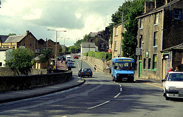
Barrowford is a large village and civil parish in Pendle. It is situated to the north of Nelson on the other side of the M65 motorway, and forms part of the Nelson conurbation. It also comprises the area of Lowerford (not to be confused with its neighbour Higherford). The parish has a population of 6,171.
Barrowford is situated on the Marsden–Gisburn–Long Preston turnpike. One of the original toll houses, dating from 1804–05, can still be seen at the junction with the road to Colne, complete with a reproduction of the table of tolls which were paid.
The toll house was restored in the 1980s and is owned by the trust which operates nearby Pendle Heritage Centre. Barrowford is located about half a mile from the Leeds and Liverpool Canal, and a set of seven locks leads to the highest section of the canal between Barrowford and Barnoldswick.
 | |
| Pendle Home & Contents | ©Lancashire OnLine Parish Clerks | Lancashire Home |